Lenshen Intelligent Smart City LiDAR sensors - High Performance
Overview of LiDAR Based Smart City System
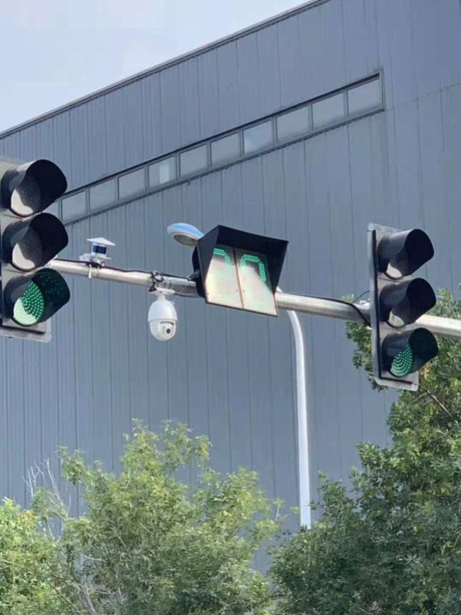
Vehicle and road synergism System is based on wireless communication, sensor detection and other technologies to obtain vehicle and road information. Through vehicle and road information interaction and sharing, it realizes intelligent collaboration and cooperation between vehicles and infrastructure, and achieves the goal of optimizing the use of system resources, improving road traffic safety and easing traffic congestion. This technology, beyond doubt, is the result of the integration of information technology with automobile and transportation industries.


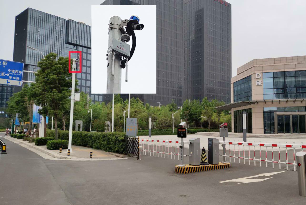
In order for cooperating with the vehicle and road, the R & D is based on the roadside LiDAR system, and it can cooperate with other multi-sensor to integrate road information, including pedestrians and objects, into V2X data network, it then broadcasts to the surrounding or further distance vehicles by the traffic control center server, and provides traffic information and traffic safety information prompts for vehicles.
Smart City LiDAR Sensors in Leishen Portfolio
Compared with traditional roadside monitoring equipment such as cameras and speed radars, lidar has an irreplaceable advantage.
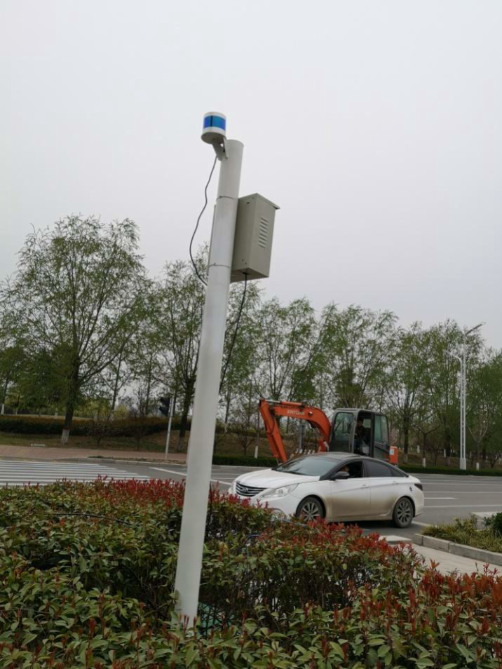
Lidar is better at long-distance detection (the farthest detection distance can reach more than 200 meters), and can provide 3D spatial data of the environment. Therefore, as a part of safety redundancy, roadside lidar improves the accuracy and safety of the overall system through data fusion with other sensors. With the support from the algorithm, the LiDAR system can achieve:
(1) Identify and distinguish dynamic targets such as passenger cars, trucks, trucks/buses, motorcycles, pedestrians, and bicycles, without violation of privacy;
(2) Continuously output the position and direction, speed, acceleration, steering angle, time distance/spacing between objects and other parameters of the dynamic target.
In terms of performance, the road end requires the lidar to have a larger sensing range and resolution. For example, in a highway scene, the roadside lidar must have the ability to accurately detect small objects in the distance, so as to reserve more time for vehicle decision-making.
LS LIDAR supply wide range of the LiDAR products for V2X / Smart City application with different ranges, channels and costs, to meet most of V2X application requirements.

CH128
Channels: 128
Wave length: 905nm
Laser Classification: Class 1 Eye-safe/ IEC 60825-1:2007 & 2014
Range: up to 150m
Data points: up to 480,000 points per second
FOV – Horizontal: 60°
FOV – vertical: -13° to 6°
Operating Temperature: -20℃~ 65℃
Application Video DEMO

CH32
Channels: 120
Wave length: 905nm
Laser Classification: Class 1 Eye-safe/ IEC 60825-1:2007 & 2014
Range: up to 200m
Data points: up to 852K points/s – Dual return
FOV – Horizontal: 120°
FOV – vertical: -6.67° to 4.58°
Operating Temperature: -20℃~ 65℃
Application Video DEMO

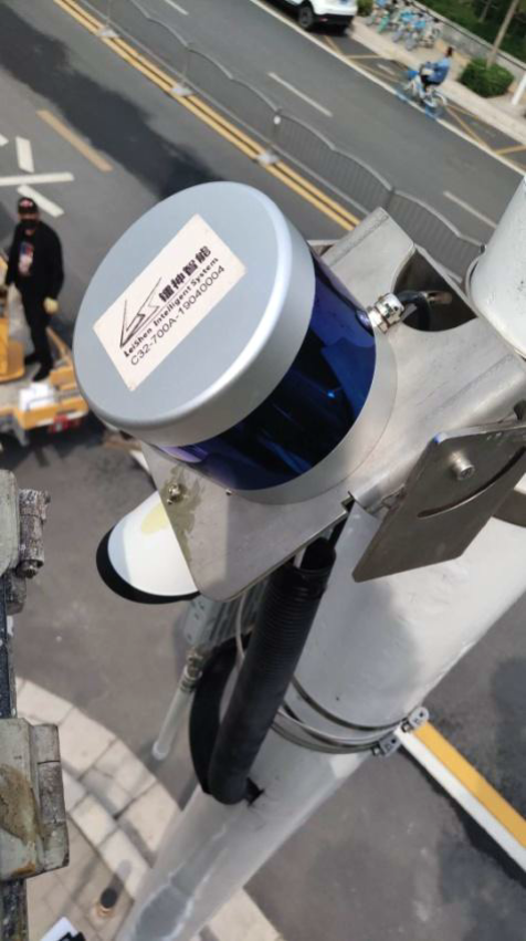
C32
Channels: 32
Wave length: 905nm
Laser Classification: Class 1 Eye-safe/ IEC 60825-1:2007 & 2014
Range: up to 150m
Data points: up to 640,000 points per second
FOV – Horizontal: 360°
FOV – vertical: -16° to 15°
Operating Temperature: -20℃~ 60℃
Application Video DEMO

C16
Channels: 16
Wave length: 905nm
Laser Classification: Class 1 Eye-safe/ IEC 60825-1:2007 & 2014
Range: up to 150m
Data points: up to 320,000 points per second
FOV – Horizontal: 360°
FOV – vertical: -15° to 15°
Operating Temperature: -20℃~ 60℃
Application Video DEMO
Leishen Smart City LiDAR System Solutions
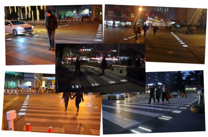
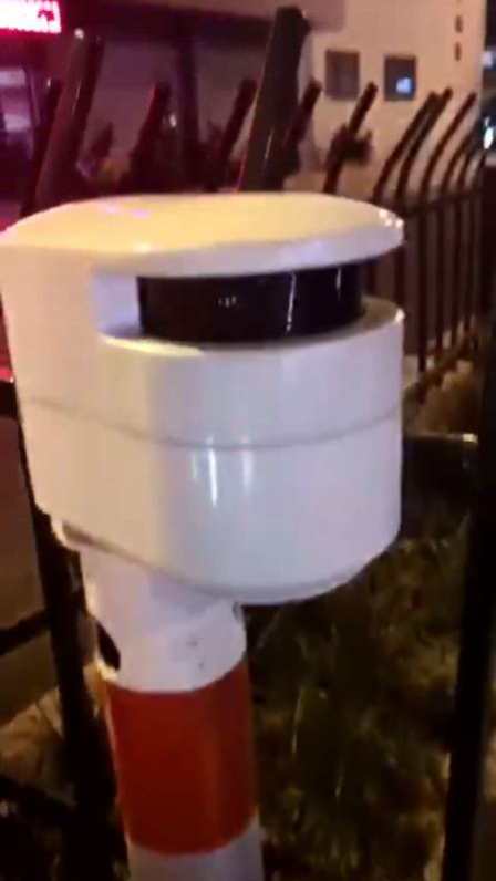
Smart Zebra LiDAR Control System
The study shows that the most accidents on the Zebra line happened during night time, so the Smart Zebra Crossing System is introduced to reduce the chance of accidents by giving out the advance light or sound warning to both the drivers and pedestrian.
The entire smart zebra lidar crossing system includes parts: sensor system (lidar and other sensors), smart zebra indication system, communication infrastructure, self-test system, server etc.


Contactless Vehicle Measurement System
Leishen LIDAR Vehicle contour detection system is a set of LiDAR and Algorithm to fulfill the smart traffic application,aiming at fully automatic, non-contact to detect the dimension (length, width, height) of the cargo,trucks,lorries running on the highway,as well as the vehicles inspection at Vehicle Administration Bureau.The state of the art system is adopting high speed LiDAR to capture the contour of vehicle quickly without stop or slow down requirement to the vehicle.The contour information includes height, width,length, tire wheelbase and other related parameters.The accuracy and anti-interference capability are significantly higher than the other non-contact detection technology (such as LiDAR,microwave, visual, etc.). LiDAR could work day and night , which could not only improve the implementation efficiency, but also reduce the staff’s workload.
Track Intrusion Dection System
The intrusion and limit of foreign object in train tracks occurs mostly in highway cross-railway sections, adjacent sections of highway and railway parallel, near construction sections, railway main lines, and sections in
mountainous areas where collapse may occur. It has the characteristics of suddenness, irregularity and unpredictability. Leishen Intelligent has launched two types (Vehicle-mounted and Roadside Fixed-Checking Point) of intelligent monitoring solutions: intrusion and limit of foreign object in Railway, based on the train operation characteristics and relying on the leading lidar sensing technology. The solutions aim at problems that
seriously threaten the safety of rail operations such as unidentified falling objects and personnel intrusion.

LS LiDARs on V2X Projects